After leaving the quagmire that was the camp in Motueka it was time to head towards the Marlborough Sounds to explore an area we had heard so much about but had never seen. After consulting the trusty Travel Directory it was obvious that you can stay at a number of DOC camps throughout the sounds with Elaine Bay and French Pass the closest and if we got sick of driving then we could stay at the POP in Okiwi Bay.


Turning off the main highway at Rai Valley the road initially runs through some really nice farms, at this time of the year it was just a sea of green grass on both sides of the road. Then however the road narrows heading uphill in what seems like a never ending corner as it works it’s way through native bush towards the top of the hill. It was just as well it’s a fairly quiet time of the year as we took the cautious approach.
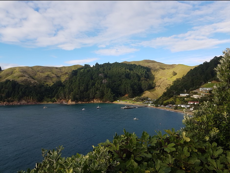
Reaching the top of the hill suddenly you are rewarded with the stunning vista above and our first glimpse of the Sounds. The road follows the ridge for a period of time before working it’s way down to Okiwi Bay.


The Park Over Property at Okiwi Bay is this large flat section right across the road from the water and would be a very popular place during the summer season but as you can see it was rather empty on the day we arrived.
Sarah noticed another couple in a motorhome that had just stopped across the road having come from the direction of French Pass so we went to talk to them to see if they had stayed anywhere in the area. They told us that they had stayed at French Pass and it was well worth the visit even if it was a bit of a drive into the camp. So we decided to head there, then work our way back down.

The road from there winds it’s way back up the hill following the ridge all the way to Elaine Bay. Whilst it’s not a bad road there are a number of areas where there has been subsidence or slips so that the road becomes either narrow or uneven meaning that it’s a slower trip than you might imagine for the distance involved.
The views of the Sounds continue all the way until you reach the Elaine Bay turn off where you can turn right to head down to that bay or continue as we did straight ahead towards French Pass.


The first 4 kms of the 22 km road are sealed although after the two kms the centre line vanishes with the road narrowing to about 1.5 car widths so a little caution is required. From there the gravel road winds it’s way through bush and whilst there were a few pot holes and ruts in the road it wasn’t in bad condition.
About the 8 km mark the road opens up onto farm land and seriously narrows but as it does so the visibility increases allowing you to see well ahead. I would not like to have driven this road in summer given that there weren’t to many places to pull over to let someone past the other way but as we only met one vehicle coming out we had plenty of time to find an area to pull over to let them past.
There are two large hills on the road that have both been sealed which was probably just as well for us on the outward journey, being front wheel drive I think traction would have been an issue on a wet day.
Coming round the corner at the top of the hill overlooking French Pass I was really surprised to see houses there, for some reason I had assumed that French Pass was a DOC camp and nothing else. Well you know what they say about people who assume things. French Pass is around 70kms from the main road and took us over an hour and a half to drive sometimes getting down to 20 or 30 kph during the rougher stretches of the road in.


The campground is much smaller than I expected stuck at the left hand end of the beach. We pulled up to be greeted by “no hurry Murray” his words not mine. That was also a surprise as at most DOC camps at this time of the year the camp host has well and truly gone home, usually at Easter. Murray told us he was filling in for another 4 weeks whilst the full time caretaker was on an extended yacht cruise.

We had our choice of spots in the deserted campground and chose a really nice spot right on the water or so it seemed as we drove right up to the edge of the bank. Not long after we arrived the real camp manager arrived to check us out. It’s good to know that DOC also has a non discrimination policy regarding physical disability with this manager having some obvious issues with it’s ability to walk due to what appears to be a crippled or damaged foot.


With the motorhome settled it was time to stretch our legs after the long drive to explore the wharf and beach. It’s really interesting at this time of the year with the sun low in the sky that it looks like evening in some of these shots but it’s actually only about 3.30pm. Not to great for our solar panels but thankfully the long drive put some decent charge into the batteries.


The walk along the waterfront brings you to this memorial stone celebrating 150 years since the establishment of the farms and the village. According to Murray the two remaining brothers who are descendants of one of the original families still owned one of the farms up until a couple of years ago but still retain a house in the bay.


Another sign of how small town New Zealand is changing is the closure of the local store as well as the school. With the drift away from the country and farms increasing in size and decreasing in the number of people required to work them it becomes much harder to continue to maintain them. Sad for the area I guess but also a reality of life.
We met some people at the local wharf who lived on D’Urville Island (A short water taxi ride away) they had driven all the way into Nelson for supplies over 100 kms away to do one months worth of shopping maybe in the past they might have been able to collect stuff from the store but with that option now gone it’s a long way to drive. You wouldn’t want to forget something.


The following morning it was time to stretch the legs getting out exploring the area. We decided that we would walk up the hill to the lookout for the lighthouse. Just above the campground is the memorial to Pelorus Jack a Risso Dolphin that played on the bow wave of ships in the area from 1888 to 1912 becoming nationally and internationally famous.

It’s also from this point that you can view the currents that swirl through the gap between the mainland and D’Urville Island if you don’t want to make the walk to the lookout further up the hill. The water flow is just incredible.


We reached the entrance to the lookout track which is about 1 km up the hill from the camp and of course the usual rule applies what goes up must come down. In other words the track to the lookout was all downhill with a very pleasant walk if a little rough in places through the bush.
As you can see from the above video the water flow through this point is just huge but what gives it the rough look is actually rocks just below the surface that cause the tidal flow to become as broken as it is.
The sign in the photo above talks about the construction of the beacon, when in 1906 after a number of temporary beacons they put this structure in place by dragging out a rowboat full of buckets of concrete at low tide then at just the right moment the rowboat was let go then when it drifted into the right spot the people in the boat held on of dear life, they then had around 30 minutes to pour the concrete which they then covered with canvas sacks during the next tide. It took weeks to build up enough of a base to build the current beacon.
The sign also talks about the Webber Family who have swum across this pass three times with five of the family completing the swim in 1991 and one member completing a double crossing in 1992.


From the lookout you can also see the lighthouse that has been built at the bottom of the cliff, however you cannot access this area as it’s private property being the home of the people who normally look after the DOC camp. I have downloaded these two photos from Google as we could not access the place to look.
Looking at those stairs it would be a brave person that climbed down these during a storm, they look so steep that I think you would descend backwards as well.
")


I am so glad that we have been walking quite a bit over the last few months otherwise I don’t think I would have coped to well with all of this up and down as we climbed back up the hill from the lookout, But then of course it was downhill back to the camp.
I always find it interesting all the plant life in different places and how each one finds it’s own special place to grow even if it’s right on the side of a cliff.
I have decided to break this post into two as there is still so much to cover so watch out for part two in the next couple of days.
Click here to read all the camp ground reviews I have published so far
Click here to view the interactive map of the places we have visited.

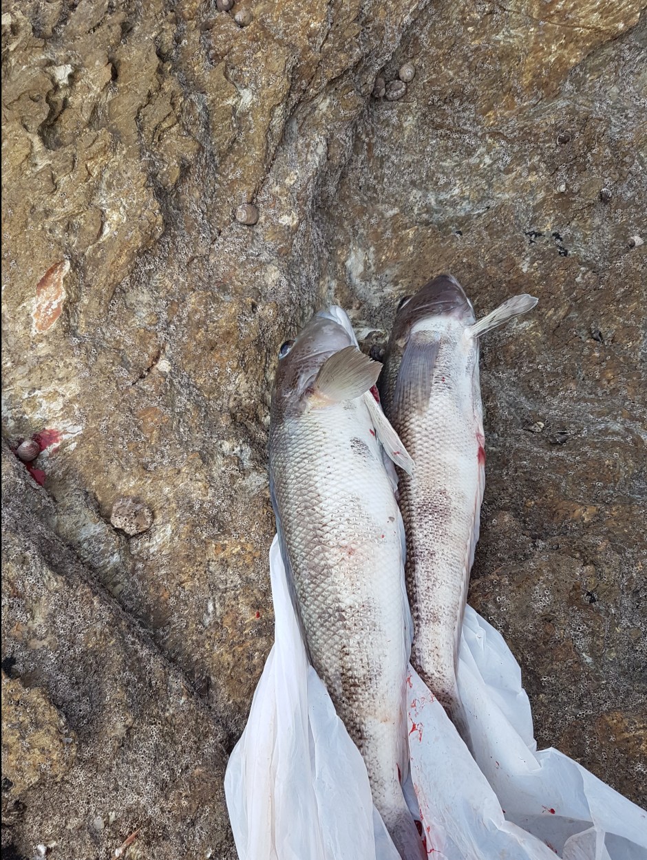
Great that you were able to do so much walking – well done. Hope that you enjoyed the fish for dinner ..
LikeLike